Another awesome trip in the bag. Did some explorations, some scary "x" stuff, and some new favorites. The Roost, Smith Fork, The Lake, and a 4 day backpack were all on the agenda. It was a great trip, I think my body is ready for about anything now... I'm feeling really good!
Sent from my Verizon Wireless BlackBerry
Wednesday, April 23, 2008
Tuesday, April 22, 2008
OK ESN:0-7342659
Checking in, everything is all good.
ESN:0-7342659
Latitude:37.688
Longitude:-110.912
Nearest Location: Eggnog, United States
Distance: 11 km(s)
Time:04/22/2008 16:40:24 (GMT)
ESN:0-7342659
Latitude:37.688
Longitude:-110.912
Nearest Location: Eggnog, United States
Distance: 11 km(s)
Time:04/22/2008 16:40:24 (GMT)
http://maps.google.com/maps?f=q&hl=en&geocode=&q=37.688,-110.912&ie=UTF8&z=12&om=1
Monday, April 21, 2008
OK ESN:0-7342659
Checking in, everything is all good.
ESN:0-7342659
Latitude:37.5786
Longitude:-110.8702
Nearest Location: Ticaboo, United States
Distance: 19 km(s)
Time:04/21/2008 13:51:48 (GMT)
ESN:0-7342659
Latitude:37.5786
Longitude:-110.8702
Nearest Location: Ticaboo, United States
Distance: 19 km(s)
Time:04/21/2008 13:51:48 (GMT)
http://maps.google.com/maps?f=q&hl=en&geocode=&q=37.5786,-110.8702&ie=UTF8&z=12&om=1
Sunday, April 20, 2008
OK ESN:0-7342659
Checking in, everything is all good.
ESN:0-7342659
Latitude:37.5787
Longitude:-110.8702
Nearest Location: Ticaboo, United States
Distance: 19 km(s)
Time:04/21/2008 01:06:33 (GMT)
ESN:0-7342659
Latitude:37.5787
Longitude:-110.8702
Nearest Location: Ticaboo, United States
Distance: 19 km(s)
Time:04/21/2008 01:06:33 (GMT)
http://maps.google.com/maps?f=q&hl=en&geocode=&q=37.5787,-110.8702&ie=UTF8&z=12&om=1
Saturday, April 19, 2008
OK ESN:0-7342659
Checking in, everything is all good.
ESN:0-7342659
Latitude:37.5786
Longitude:-110.8701
Nearest Location: Ticaboo, United States
Distance: 19 km(s)
Time:04/20/2008 01:31:10 (GMT)
ESN:0-7342659
Latitude:37.5786
Longitude:-110.8701
Nearest Location: Ticaboo, United States
Distance: 19 km(s)
Time:04/20/2008 01:31:10 (GMT)
http://maps.google.com/maps?f=q&hl=en&geocode=&q=37.5786,-110.8701&ie=UTF8&z=12&om=1
Friday, April 18, 2008
Last day on the lake
Today was the grand finale, possibly the best canyon I've yet done... Ever! Wow, it was soo good! Can't wait to get back on the lake one of these days.
Sent from my Verizon Wireless BlackBerry
Sent from my Verizon Wireless BlackBerry
OK ESN:0-7342659
Checking in, everything is all good.
ESN:0-7342659
Latitude:37.1182
Longitude:-110.956
Nearest Location: Rainbow City, United States
Distance: 18 km(s)
Time:04/18/2008 23:32:42 (GMT)
ESN:0-7342659
Latitude:37.1182
Longitude:-110.956
Nearest Location: Rainbow City, United States
Distance: 18 km(s)
Time:04/18/2008 23:32:42 (GMT)
http://maps.google.com/maps?f=q&hl=en&geocode=&q=37.1182,-110.956&ie=UTF8&z=12&om=1
OK ESN:0-7342659
Checking in, everything is all good.
ESN:0-7342659
Latitude:37.1182
Longitude:-110.956
Nearest Location: Rainbow City, United States
Distance: 18 km(s)
Time:04/18/2008 13:24:24 (GMT)
ESN:0-7342659
Latitude:37.1182
Longitude:-110.956
Nearest Location: Rainbow City, United States
Distance: 18 km(s)
Time:04/18/2008 13:24:24 (GMT)
http://maps.google.com/maps?f=q&hl=en&geocode=&q=37.1182,-110.956&ie=UTF8&z=12&om=1
Thursday, April 17, 2008
Another day
Today was another exploration. We thought the canyon would be really short and end in a big drop. The canyon was short length wise but had something like 11 drops with huge pools and potholes, a couple being keepers. The big drop at the end never came. It was a really great canyon and a lot different than anything else on the trip. Tomorrow we do blasphemy canyon and then its back to land for more exploration canyons. Mom, I will probably come do my laundry on Wednesday if you will be around. PS. I can get emails out here at least until Saturday morning.
Sent from my Verizon Wireless BlackBerry
Sent from my Verizon Wireless BlackBerry
OK ESN:0-7342659
Checking in, everything is all good.
ESN:0-7342659
Latitude:37.1183
Longitude:-110.9561
Nearest Location: Rainbow City, United States
Distance: 18 km(s)
Time:04/17/2008 14:06:24 (GMT)
ESN:0-7342659
Latitude:37.1183
Longitude:-110.9561
Nearest Location: Rainbow City, United States
Distance: 18 km(s)
Time:04/17/2008 14:06:24 (GMT)
http://maps.google.com/maps?f=q&hl=en&geocode=&q=37.1183,-110.9561&ie=UTF8&z=12&om=1
Wednesday, April 16, 2008
OK ESN:0-7342659
Checking in, everything is all good.
ESN:0-7342659
Latitude:37.1183
Longitude:-110.956
Nearest Location:not known
Distance:not known
Time:04/17/2008 00:06:38 (GMT)
ESN:0-7342659
Latitude:37.1183
Longitude:-110.956
Nearest Location:not known
Distance:not known
Time:04/17/2008 00:06:38 (GMT)
http://maps.google.com/maps?f=q&hl=en&geocode=&q=37.1183,-110.956&ie=UTF8&z=12&om=1
More lake
Insane winds yesterday with scary waves but all worked out, time for x communication canyon today
Sent from my Verizon Wireless BlackBerry
Sent from my Verizon Wireless BlackBerry
More lake
Insane winds yesterday with scary waves but all worked out, time for x communication canyon today
Sent from my Verizon Wireless BlackBerry
Sent from my Verizon Wireless BlackBerry
More lake
Insane winds yesterday with scary waves but all worked out, time for x communication canyon today
Sent from my Verizon Wireless BlackBerry
Sent from my Verizon Wireless BlackBerry
Tuesday, April 15, 2008
OK ESN:0-7342659
Checking in, everything is all good.
ESN:0-7342659
Latitude:37.1399
Longitude:-110.9514
Nearest Location:not known
Distance:not known
Time:04/15/2008 14:34:07 (GMT)
ESN:0-7342659
Latitude:37.1399
Longitude:-110.9514
Nearest Location:not known
Distance:not known
Time:04/15/2008 14:34:07 (GMT)
http://maps.google.com/maps?f=q&hl=en&geocode=&q=37.1399,-110.9514&ie=UTF8&z=12&om=1
Monday, April 14, 2008
OK ESN:0-7342659
Checking in, everything is all good.
ESN:0-7342659
Latitude:37.1183
Longitude:-110.956
Nearest Location: Rainbow City, United States
Distance: 18 km(s)
Time:04/15/2008 01:42:27 (GMT)
ESN:0-7342659
Latitude:37.1183
Longitude:-110.956
Nearest Location: Rainbow City, United States
Distance: 18 km(s)
Time:04/15/2008 01:42:27 (GMT)
http://maps.google.com/maps?f=q&hl=en&geocode=&q=37.1183,-110.956&ie=UTF8&z=12&om=1
It's on
On the way to inquisition canyon. Having a great time. I'll see you guys later.
Sent from my Verizon Wireless BlackBerry
Sent from my Verizon Wireless BlackBerry
The lake
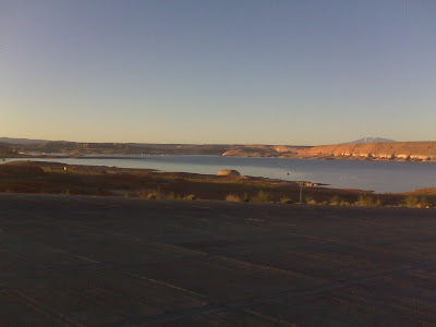
Sent from my Verizon Wireless BlackBerry
Saturday, April 12, 2008
OK ESN:0-7342659
Checking in, everything is all good.
ESN:0-7342659
Latitude:37.6094
Longitude:-110.7053
Nearest Location: Ticaboo, United States
Distance: 7 km(s)
Time:04/13/2008 03:05:54 (GMT)
ESN:0-7342659
Latitude:37.6094
Longitude:-110.7053
Nearest Location: Ticaboo, United States
Distance: 7 km(s)
Time:04/13/2008 03:05:54 (GMT)
http://maps.google.com/maps?f=q&hl=en&geocode=&q=37.6094,-110.7053&ie=UTF8&z=12&om=1
OK ESN:0-7342659
Checking in, everything is all good.
ESN:0-7342659
Latitude:37.6072
Longitude:-110.6246
Nearest Location:not known
Distance:not known
Time:04/12/2008 21:22:42 (GMT)
ESN:0-7342659
Latitude:37.6072
Longitude:-110.6246
Nearest Location:not known
Distance:not known
Time:04/12/2008 21:22:42 (GMT)
http://maps.google.com/maps?f=q&hl=en&geocode=&q=37.6072,-110.6246&ie=UTF8&z=12&om=1
OK ESN:0-7342659
Checking in, everything is all good.
ESN:0-7342659
Latitude:37.6195
Longitude:-110.642
Nearest Location: Ticaboo, United States
Distance: 8 km(s)
Time:04/12/2008 17:56:26 (GMT)
ESN:0-7342659
Latitude:37.6195
Longitude:-110.642
Nearest Location: Ticaboo, United States
Distance: 8 km(s)
Time:04/12/2008 17:56:26 (GMT)
http://maps.google.com/maps?f=q&hl=en&geocode=&q=37.6195,-110.642&ie=UTF8&z=12&om=1
Friday, April 11, 2008
OK ESN:0-7342659
Checking in, everything is all good.
ESN:0-7342659
Latitude:38.3845
Longitude:-110.4689
Nearest Location: Hanksville, United States
Distance: 21 km(s)
Time:04/11/2008 23:29:39 (GMT)
ESN:0-7342659
Latitude:38.3845
Longitude:-110.4689
Nearest Location: Hanksville, United States
Distance: 21 km(s)
Time:04/11/2008 23:29:39 (GMT)
http://maps.google.com/maps?f=q&hl=en&geocode=&q=38.3845,-110.4689&ie=UTF8&z=12&om=1
OK ESN:0-7342659
Checking in, everything is all good.
ESN:0-7342659
Latitude:39.4231
Longitude:-110.4439
Nearest Location: Cedar, United States
Distance: 3 km(s)
Time:04/11/2008 13:25:27 (GMT)
ESN:0-7342659
Latitude:39.4231
Longitude:-110.4439
Nearest Location: Cedar, United States
Distance: 3 km(s)
Time:04/11/2008 13:25:27 (GMT)
http://maps.google.com/maps?f=q&hl=en&geocode=&q=39.4231,-110.4439&ie=UTF8&z=12&om=1
Subscribe to:
Posts (Atom)
